An emerging super El Niño could have wide-reaching impacts, from fewer Atlantic hurricanes to wetter conditions across the southern U.S.
WASHINGTON — A super El Niño is an especially strong phase of the El Niño–Southern Oscillation, when sea surface temperatures in the central and eastern equatorial Pacific become significantly warmer than average—typically exceeding about +2.0°C above normal.

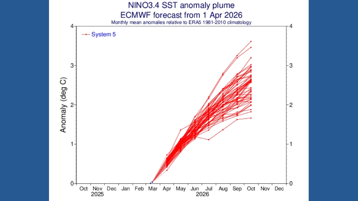
Recent mean forecast guidance from the European Centre for Medium-Range Weather Forecasts suggests this event could reach around +2.5°C, with warming continuing into October 2026.
This level of warming places it firmly in “super” El Niño territory. As these ocean temperatures increase, they shift where storms form in the tropics, which in turn reshapes global atmospheric patterns. During a super El Niño, these global changes are amplified, strengthening the Pacific jet stream and redistributing heat and moisture on a global scale.
What makes this notable is that oceans and surface temperatures are already elevated compared to pre‑industrial levels (mid‑to‑late 19th century), meaning El Niño will be riding on a warmer baseline compared to previous years. Potentially amplifying its influence on the climate system.
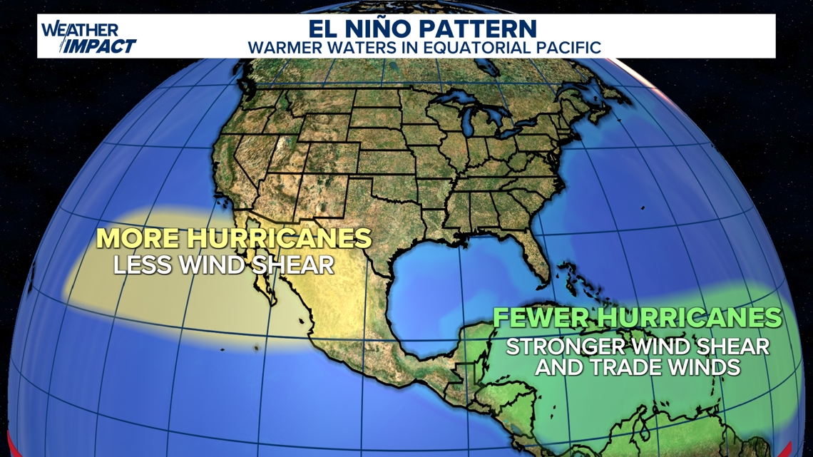
One of the most consistent impacts is on Atlantic hurricane season. Strong El Niño conditions increase upper-level winds across the tropical Atlantic—known as wind shear—which disrupts storm development and makes it difficult for hurricanes to organize and intensify.
As a result, super El Niño years are often associated with below-average Atlantic hurricane activity. Meanwhile, the eastern Pacific tends to be more enhanced, with warmer waters and favorable conditions supporting an increase in tropical storm and hurricane development.
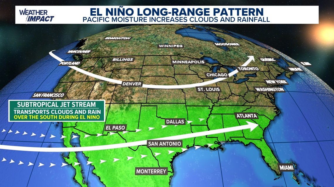
Across the United States, a super El Niño significantly influences seasonal rainfall, especially during winter. The stronger, more active jet stream typically shifts south, bringing wetter-than-average conditions to the southern U.S., including California, the Gulf Coast, and the Mid-South.
This pattern can be especially beneficial for drought-stricken areas across the South, where repeated storm systems help replenish soil moisture, improve river and reservoir levels, and support agriculture heading into the next growing season. In contrast, the northern tier—such as the Pacific Northwest and parts of the Midwest—often sees drier and sometimes warmer conditions.
While the increased rainfall in the South can raise concerns about flooding, it also provides a meaningful opportunity for drought relief.
When scientists speak about historic strong El Niño events, they often reference these years, 1982‑83, 1997‑98, and 2015‑16 as benchmarks for comparison. There is growing discussion among forecasters that this could rival those historic events in magnitude — and, if the anomaly really does reach that level, it would be among the strongest in recorded history.
However, forecasters caution that these outlooks made this far in advance have uncertainty, and the exact peak strength won’t be known until later this year.
Source link
Ryan Shoptaugh What is a super El Niño? Here’s what the weather pattern means for hurricanes and US weather. www.12news.com
KPNX Arizona Local News Feed: weather 2026-04-06 14:28:55
weather,nation-world,news,cct-tracking,syndication +

GIPHY App Key not set. Please check settings