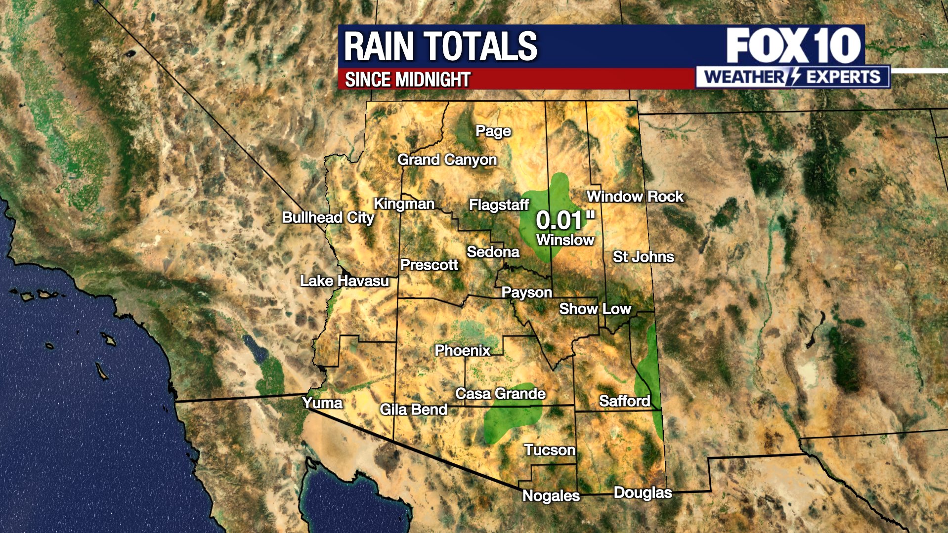
PHOENIX – It’s been a cooler and wetter start to the day with light rain and snow along some parts of the state.

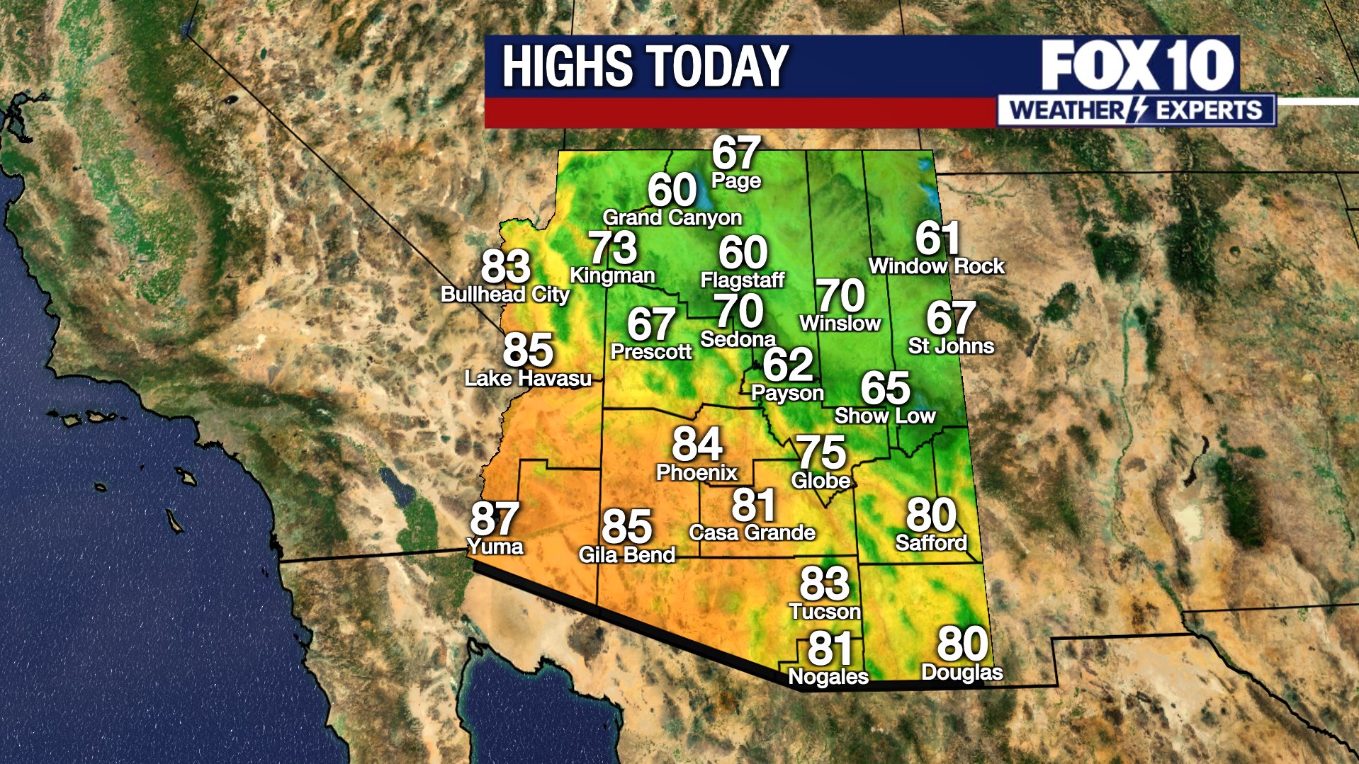
Portions of northern Arizona woke up to light rain and snow this morning with the highest accumulations at higher elevations. Snow will favor elevations around 5,000 to 6,000 feet with up to an inch or two of snow. Some areas above 6,000 feet could see higher amounts.
What To Expect:
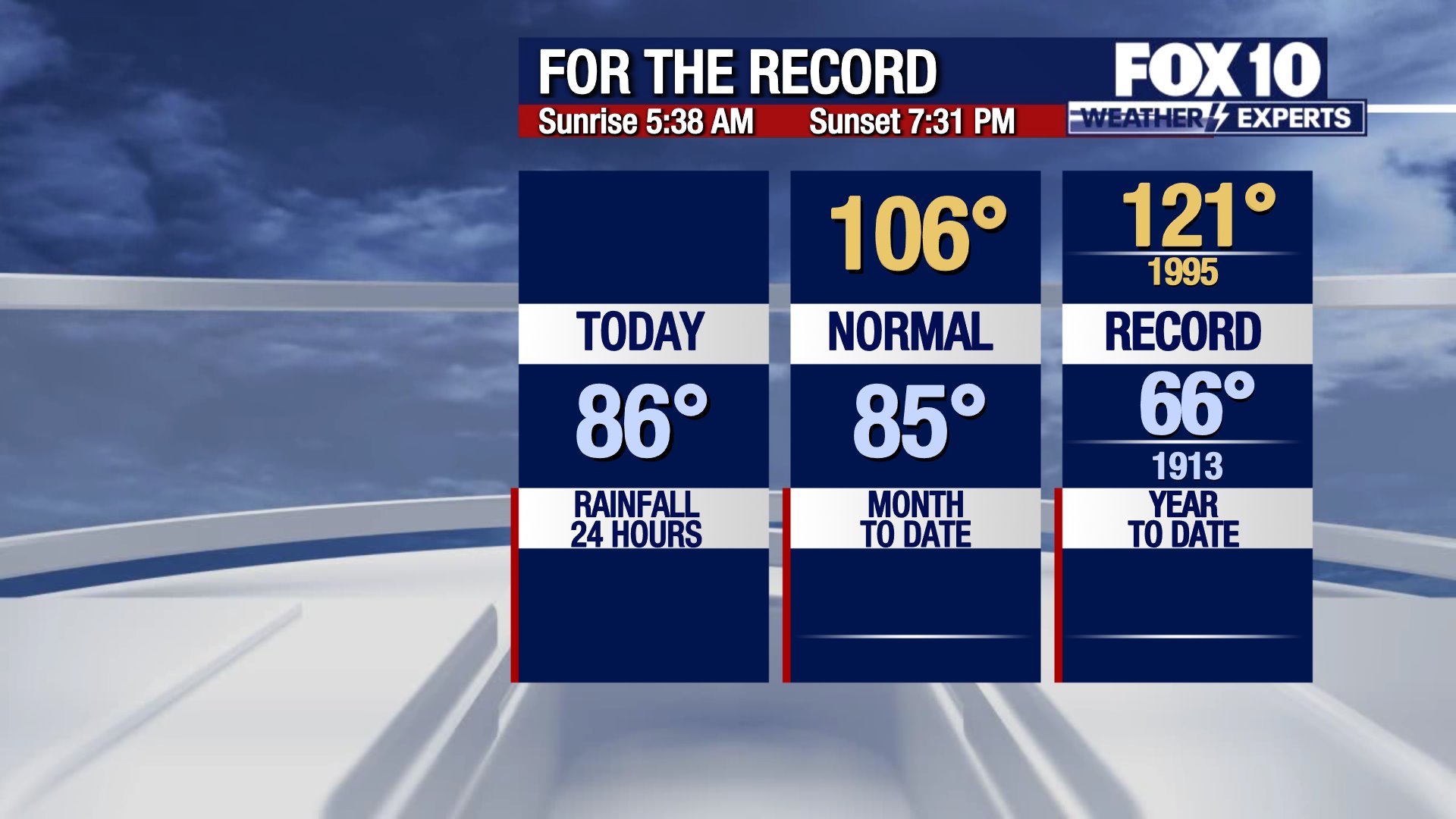
Precipitation will continue through tonight and end by Thursday. A lake wind advisory will continue this evening for Lake Mead and Lake Mohave for wind gusts up to 35 mph. The Valley will remain dry with an average high of around 68 degrees. Overnight lows tonight will fall in the upper 30s to 40s across the Valley. Temperatures will continue to drop near to slightly below normal this week before a warming trend next week.
By next week, above normal temperatures in the 70s return, along with warmer overnight lows.
You can always check the latest weather conditions by visiting the FOX 10 Phoenix weather page, or download the Free FOX 10 Weather app, which is available on Apple iOS and Android.
Scroll down this page for satellite and radar, day planner, records, current temperatures, 10-day forecast, forecast highs, and recent rainfall totals, plus live video feeds.


Road Conditions
- Call 511 anywhere in Arizona or 1-888-411-ROAD (7623)
- az511.com
The Source: Information for this story was provided by the FOX 10 Weather Experts.
Source link
[email protected] (FOX 10 Staff) Arizona weather forecast: Near-average highs continue in the Valley www.fox10phoenix.com
Latest News | FOX 10 2025-12-03 14:27:47
+

GIPHY App Key not set. Please check settings